
JazaMiti Digital Platform 2026: How Kenya Plans to Geo-Tag 17.2 Million Trees and Track Survival

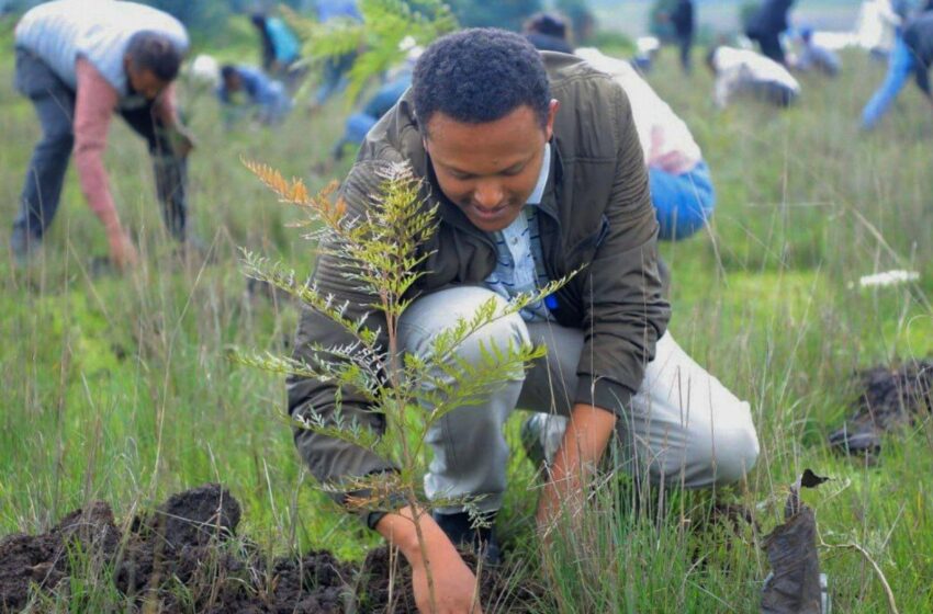
A past tree-planting session geared toward restoring the country’s forest cover/FILE
The ambitious tree-growing campaign is entering a new phase as the government turns to digital technology to document planting activities, map seedlings and monitor their survival beyond national environmental celebrations.
The National Mazingira Day campaign on October 10, 2026, targets 17.24 million trees during Mazingira Week, with the JazaMiti digital platform expected to support geo-tagging, real-time counting and certification. The initiative forms part of the wider national programme to grow 15 billion trees by 2032, restore degraded landscapes and increase Kenya’s tree cover.
According to the State Department for Forestry, the government is bringing together national and county institutions, educational establishments, communities and other stakeholders to expand tree-growing activities.
PAY ATTENTION: Follow Kenya Frontline WhatsApp channel for more news
The technology raises an important question: can Kenya move beyond impressive planting figures to establish how many seedlings survive, mature and contribute to environmental restoration?
That distinction matters. A seedling planted during a national campaign may be counted immediately, but its long-term environmental value depends on whether it receives sufficient water, survives changing weather conditions and grows into an established tree.
JazaMiti platform: From planting figures to verifiable environmental data
The government’s JazaMiti initiative is designed to help users document tree-growing activities and monitor tree growth over time. Its official mobile application terms, published by the Kenya Forestry Research Institute (KEFRI), describe functions that include helping users identify suitable tree species according to location and recording trees for subsequent monitoring.
The platform therefore offers a potential foundation for more accountable environmental reporting.
During Mazingira Week, the government intends to use digital tools to support the documentation of planting activities across different locations. Environment Cabinet Secretary Deborah Barasa has emphasised that trees will be counted, geo-tagged and certified, placing accountability alongside the national planting target.
The distinction between a planting record and a verified surviving tree is central to the programme.
A planting record establishes that a tree-growing activity was reported at a particular location. Subsequent monitoring can help determine whether the seedling remains alive, whether it has grown and whether it requires additional attention.
Read Also: Pharmacy Board Looks to Shape Future of Pharmaceutical Practice
However, publicly available announcements do not disclose the complete technical specifications of the updated JazaMiti platform. Details such as its cloud provider, database architecture, application programming interfaces and the precise algorithms used to verify survival have not been established in the published information reviewed for this article.
Those distinctions matter because a digital platform can improve record-keeping without automatically proving that every reported tree exists or survives.
GIS and geo-tagging: How location data can strengthen accountability
Geographic information systems (GIS) provide a practical way to associate environmental records with specific locations.
In a tree-growing programme, geo-tagging can connect a reported planting activity to geographical coordinates, the planting site and other relevant information. Depending on the platform’s design, a record may also include the tree species, planting date, number of seedlings and the organisation responsible for the activity.
The approach could help officials distinguish between trees planted in public forests, school compounds, community restoration sites and farms.
It could also make it easier to identify areas with significant planting activity and locations where follow-up inspections are needed.
For example, a school reporting 200 seedlings could have its planting activity recorded against its location. A later inspection could establish how many seedlings remain alive and whether the site needs additional maintenance.
The same principle could apply to community forest associations and county-led restoration projects.
Kenya’s existing JazaMiti national dashboard provides a public-facing view of tree-growing records, county information, nurseries and progress towards the national target. The dashboard identifies its displayed information as demo data, an important qualification when interpreting the figures shown on the interface.
A map can make large volumes of environmental data easier to understand, but the reliability of its conclusions depends on the accuracy and completeness of the underlying records.
Duplicate submissions, incorrect coordinates, inaccurate tree counts and outdated survival information could distort the picture if they are not identified and corrected.
Read Also: KNEC Grade 10 Assessment 2026: Guidelines, Timelines & School Requirements
Effective geo-tagging therefore requires more than recording a location. It needs validation procedures, clear responsibility for submitted data and mechanisms for correcting errors.
Real-time counting does not automatically mean real-time survival verification
The government’s emphasis on real-time counting marks an important step towards improving visibility across the national tree-growing campaign.
However, counting seedlings and verifying their survival are different technical tasks.
A digital submission can be recorded shortly after planting, allowing the responsible institution to report its activities without waiting for a central manual compilation. Establishing whether those seedlings remain alive requires later observations.
Survival monitoring could involve scheduled physical inspections, updated records submitted by participating institutions, photographs and other evidence, depending on the verification procedures adopted.
Mobile technology can make this process more efficient by allowing authorised users to update records from planting sites. Where connectivity is limited, an offline data-entry option could help users record observations and synchronise them when a connection becomes available, if supported by the application.
These are possible implementation approaches rather than confirmed features of JazaMiti 2026.
Satellite imagery and remote sensing could also contribute to landscape-level assessments. They can help identify changes in vegetation over time, although distinguishing individual seedlings from existing vegetation can be difficult, particularly during early growth.
Ground inspections would remain important for confirming individual tree survival and identifying problems such as drought stress, disease or damage from livestock.
The critical test will be whether the platform establishes a consistent monitoring schedule and distinguishes between seedlings reported as planted, seedlings subsequently inspected and trees confirmed to be surviving.
Without that distinction, a large planting figure could be mistaken for evidence of successful restoration.
Schools, TVETs and counties: Building a connected reporting system
The scale of Mazingira Day requires coordination across institutions with different responsibilities and operational capacities.
The government has indicated that basic education institutions and technical and vocational education and training (TVET) institutions will participate in the tree-growing campaign. Public agencies, community groups and county structures will also contribute to the national target.
The official Mazingira Day preparations announcement outlines the participation of national and county governments, communities and institutions in the nationwide exercise.
For a digital reporting system to support such a broad programme, each participating organisation needs a practical way to submit reliable information.
Schools could maintain records of planting activities within their compounds, while TVET institutions could contribute through campus restoration projects and environmental training. County officers and community forest associations could document activities in designated restoration areas.
A central reporting system could then consolidate submissions, making it easier for officials to review reported planting numbers and identify gaps in coverage.
The process would also need clear rules on who can create, amend and approve records. Without appropriate access controls, the same planting activity could potentially be reported by several participants, inflating the totals.
Institutional participation must also extend beyond the planting day. Schools need to assign responsibility for watering and protecting seedlings, while community groups require clear arrangements for maintenance and follow-up inspections.
The Kenya Forest Service has urged Kenyans to use the JazaMiti application to record, monitor and track tree-growing activities as part of the wider restoration campaign.
That emphasis on continued monitoring is important because the environmental benefits of tree growing develop over time rather than immediately after planting.
JazaMiti USSD code could widen public participation
One of the notable developments surrounding Mazingira Day 2026 is the planned launch of a JazaMiti USSD code.
USSD services generally allow users to access simple digital functions through a mobile phone menu without requiring a smartphone application or mobile internet connection. Their accessibility could make them useful for people in rural areas and communities where reliable internet access is limited.
The government has announced the launch as part of the wider Mazingira Day programme, although the complete service instructions, supported functions and registration requirements should be confirmed through official channels.
If the service enables users to submit planting information or access basic programme functions, it could widen participation beyond those comfortable using smartphone applications.
Nevertheless, USSD and mobile applications serve different purposes. A menu-based service is well suited to straightforward transactions, while more detailed functions involving maps, photographs and complex records may require a smartphone interface or another reporting channel.
The effectiveness of the new service will depend on its ease of use, the availability of support and how submitted information is validated.
Kenyans seeking to participate should consult the official JazaMiti dashboard and the State Department for Forestry for verified platform information rather than relying on unconfirmed registration instructions.
Carbon accounting: Can tree records support climate reporting?
Reliable tree-growing records could eventually contribute to Kenya’s wider climate and environmental reporting, but the connection between planting data and verified carbon benefits requires careful assessment.
Read Also: Kenyan marathoner remanded over Ksh8 million land fraud case
Trees absorb carbon dioxide as they grow, storing carbon in their trunks, branches, roots and surrounding ecosystems. The amount stored varies according to species, age, growth conditions, survival rates and the management of the surrounding landscape.
A record showing that 1,000 seedlings were planted therefore cannot, by itself, establish how much carbon dioxide has been removed from the atmosphere.
A credible carbon accounting framework would need to distinguish between planting numbers and measurable changes in carbon stocks. It would also require appropriate methods for estimating tree growth, accounting for mortality and avoiding double-counting across different reporting systems.
Geo-tagged records could help establish where restoration activities take place and provide a foundation for subsequent monitoring. When combined with suitable field measurements and scientifically defensible estimation methods, these records could support broader assessments of restoration outcomes.
However, there is no sufficient public evidence to conclude that the JazaMiti 2026 update independently calculates verified carbon offsets or issues carbon credits.
Such claims would require information about the applicable accounting methodology, verification procedures and arrangements for independent review.
The platform’s immediate value lies in improving the documentation and monitoring of tree-growing activities. Any future use in formal carbon markets would require additional safeguards and clearly defined standards.
The real test begins after Mazingira Day
Kenya’s target of 17.24 million trees during Mazingira Week is an ambitious undertaking involving communities, institutions and public agencies across the country.
The wider 15 Billion Tree Growing Programme aims to restore degraded landscapes and increase tree cover as part of the country’s environmental ambitions for 2032.
JazaMiti could help strengthen that effort by making planting records easier to organise, locating activities geographically and supporting follow-up monitoring.
But technology alone cannot guarantee successful restoration. Seedlings still require appropriate species selection, suitable planting conditions, water, protection and sustained maintenance.
The government will also need to communicate how reported figures are validated, how survival rates are calculated and how frequently planting sites are inspected.
Transparent reporting would allow citizens to distinguish between the number of trees planted during a campaign and the number that continue to grow in subsequent months and years.
Ultimately, the success of JazaMiti should not be measured only by the volume of information entering its database. Its significance will depend on whether that information helps officials, communities and institutions make better decisions about where to plant, which areas need attention and how restoration efforts are performing.
Mazingira Day can generate momentum, but lasting environmental progress depends on what happens after the celebrations end.
If Kenya can combine accessible digital reporting with credible field verification and long-term tree care, JazaMiti could become an important tool in turning national planting targets into measurable environmental outcomes.